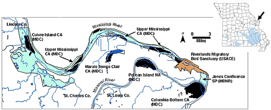
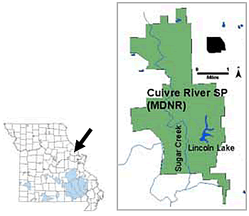
Site Description
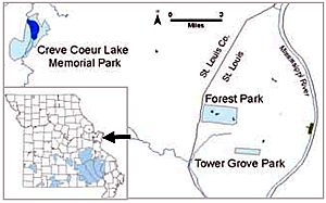
St. Louis Urban Oases IBA
As the name of the St. Louis Urban Oases IBA suggests, habitat for many species is limited within the heavily urbanized St. Louis metropolitan area. What was a St. Louis Urban Oases IBA mosaic of prairie, savanna, woodland, and forest (Nigh and Schroeder 2002) has long since gone through transitions of farmland to urban development, with little natural habitat remaining. What remains is planted or second growth forest, some of which has matured well into hardwood forest with large diameter trees and a natural forest understory (e.g., John F. Kennedy Memorial Forest in Forest Park, where some oaks may be pre-settlement relicts), and “old-growth” urban parkland (Tower Grove Park). Oxbow lakes formed from the Missouri River remain in and near Creve Coeur Park, providing wetland habitats of open water and cattail and shrub marshland.
All of the landholdings that encompass this IBA are publicly-owned. Creve Coeur Park (1,917 acres, 776 ha) is maintained by the St. Louis County Parks Department, while Forest Park (1,307 acres, 529 ha) and Tower Grove Park (291 acres, 118 ha) are managed by St. Louis Parks and Recreation. Within Forest Park is the 80-acre John F. Kennedy Memorial Forest, which is managed in cooperation with the Missouri Department of Conservation(MDC).
Ornithological Summary
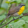
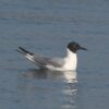
The wetlands at Creve Coeur Lake Memorial Park provide habitat for many migrating waders, waterfowl, and shorebirds. There is evidence of breeding American Bittern at Creve Coeur Lake, and Least Bittern, Pied-billed Grebe, and Common Moorhen have all been observed there during their respective breeding seasons. King, Virginia, and Black Rails have been observed there as well (Palmer and Palmer 2001). This park, and the more urban-isolated forests of the two city parks, also provide stopover habitat for many passerine migrant species in spring and fall (Korotev 1999), in addition to some breeding habitat for many birds excluded from the surrounding urban landscape (e.g., hawks and owls). Tower Grove Park is a renowned location for St. Louis birders during spring migration (Palmer and Palmer 2001), due to the amazing numbers and diversity of migrating songbirds that stopover on the site, especially warblers.
Conservation Issues
Wetland protection and water level manipulation are being done in and around Creve Coeur Lake and the nearby Little Creve Coeur Lake. The St. Louis Audubon Society and the Webster Groves Nature Study Society have coordinated with the St. Louis County Parks Department in developing a master plan for management of Creve Coeur Park. A goal of the Forest Park Master Plan is wildlife habitat improvement. These improvements include removal of invasive honeysuckle from the understory of Kennedy Forest and planting of native savanna vegetation. Plantings of trees are still being done in Tower Grove Park.